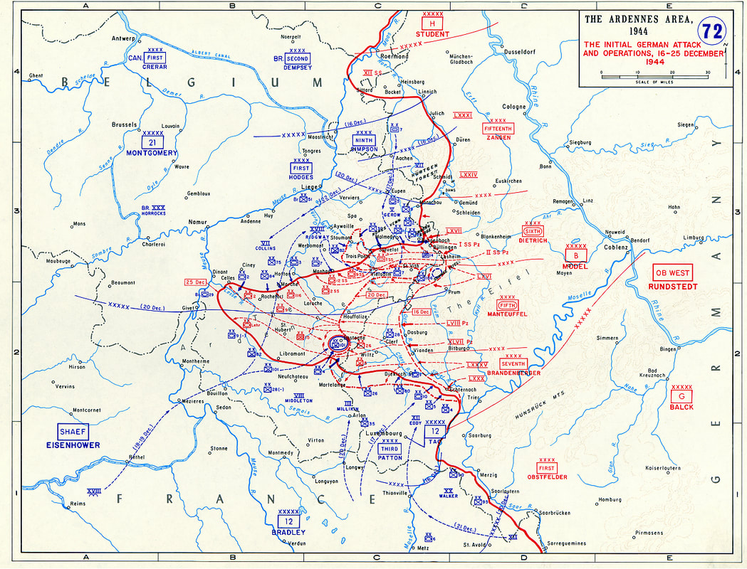
Map of the Ardennes Area, 1944
The Initial German Attack and Operations from December 16 - 25, 1944
The Battle of the Bulge (also known as the Ardennes Counteroffensive) was the last major German offensive campaign on the Western Front during WWII. It was launched through the dense forests of the Ardennes region in eastern Belgium, Luxembourg, Saarland in Germany and the Alsace-Lorraine region in northeast France from 16 Dec 1944 to 25 Jan 1945. The offensive was intended to stop the Allies’ use of the Belgian port of Antwerp and to split the Allied line of defense (red line on the map). The Germans were unsuccessful in breaking through the line of defense - they only created a “bulge” in the line before they were defeated (hence, the name “Battle of the Bulge”). British Prime Minister Winston Churchill called it "...undoubtedly the greatest American battle of the war..”
Map provided by Patrick Brion